
Basin Creek Trail
Caudill Cabin
This trail is a 9.6 out and back trail located in the Doughton Park area of the Blue Ridge Parkway. The trail head for Basin Creek starts 1.5 miles from the road side parking area, after following a fire road to get to the trail head. This is not marked at the trail head.


Caudill Cabin – Basin Creek Trail
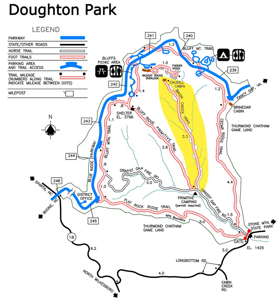
To reach the road where this trail is located, here is a link to the map, or if you just need the address it is 6879 Longbottom Rd, Hays, NC 28635
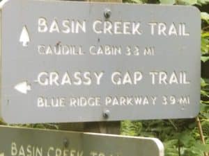
The trail named “Basin Creek Trail”, does not begin until you are about a mile and a half in on the Grassy Gap Fire Road which is what leads you from the road where you park to the trail head.
To reach the road where this trail is located, here is a link to the map, or if you just need the address it is 6879 Longbottom Rd, Hays, NC 28635
Once you hike about a mile and a half up the Grassy Gap Fire Road you will come to some great primitive camping sites.
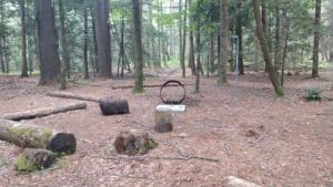
Primitive Camping Sites
There are several available with fire rings and lantern posts (do people actually hike lanterns in over a mile?).
Each site also seemed to come with it’s own food storage container. Not sure if this was from bear or other critters, but it would not be impossible to have bear in the area, although I do not think it is extremely common in this area.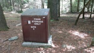
Primitive Camping Food Storage ContainersEach site also seemed to come with it’s own food storage container. Not sure if this was from bear or other critters, but it would not be impossible to have bear in the area, although I do not think it is extremely common in this area.
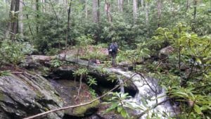
So here is where the fun really begins! The Basin Creek Trail, is 3.3 miles out and back, unless you want to bushwack your way on up to the parkway (I attempted; it is possible but it is extremely steep past the cabin).
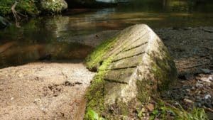
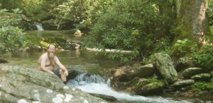
Mill Stone Swimming Hole
Along the way, we came to an really nice swimming hole, and couldn’t resist.
We named it “mill stone swimming hole” in our GPS tracking app, (GPS coordinates: 36°23’55.0″N+81°09’37.5″W ) in case we ever take the trail again. You can see from the pictures why it was named this.
Chimneys of Cabins that are long gone
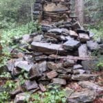
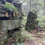
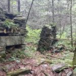
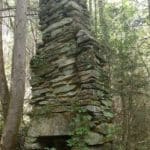


There are several chimneys that you will pass as you travel along the trail. The most interesting being the one where two chimneys are side by side. We pondered this one for a while, and decided that it was probably a larger house with two chimneys rather than two cabins built so close together. Maybe even a multi-generational cabin. It was situated on a slight hill which gave it great access to the creek but probably kept it dry, except for the large flood of 1916, more on that later.
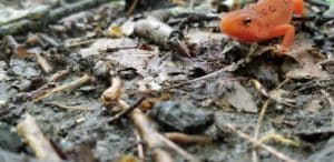
Other interesting finds along the way
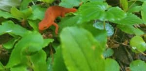
At the waterfall, I seemed to have gained a hitch hiker.

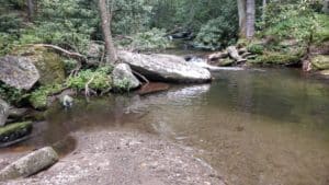
Waterfalls and Creek Crossings

There are some waterfalls visible along the trail and a couple of really easy creek crossings. Although it started raining on us during our trip up there did not seem to be any issues with slippery rocks or any problems with the trail. 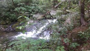


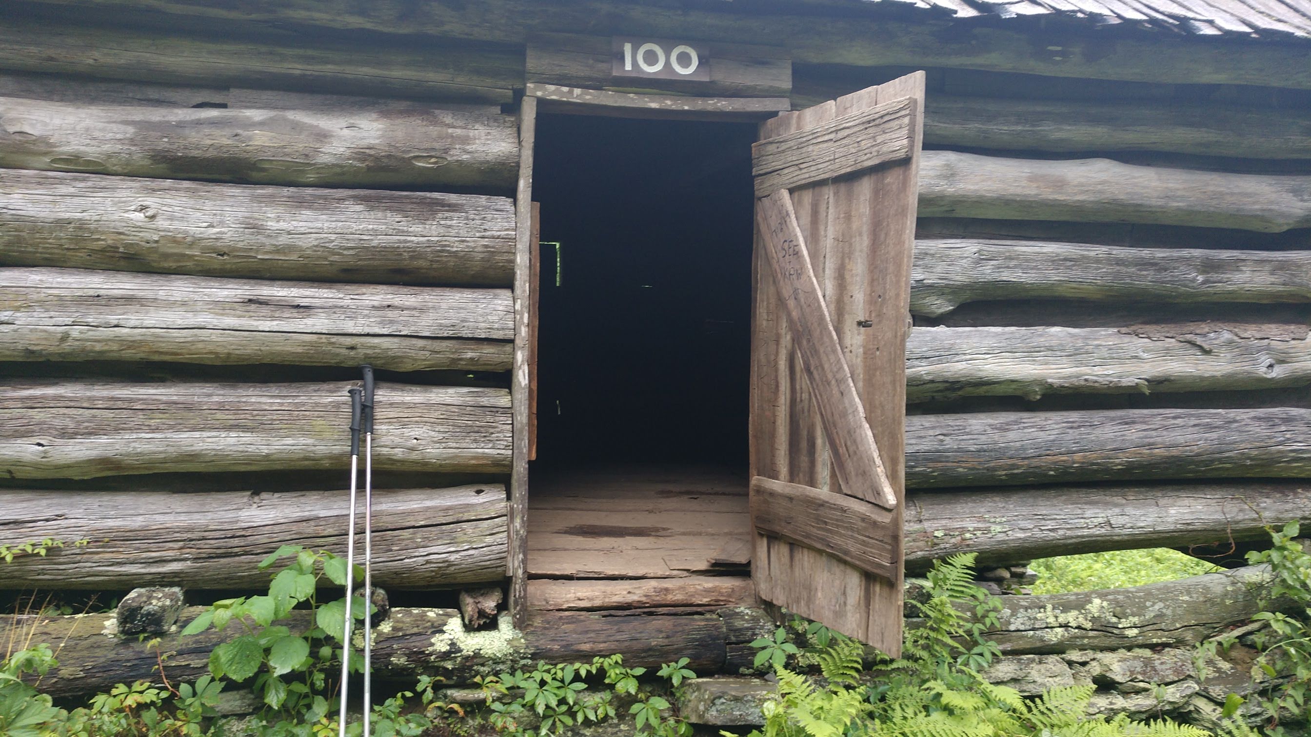
Made it to the cabin!
After the 3.3 miles and a 2500 feet elevation climb, you come upon a clearing and the cabin sits on top of the hill. 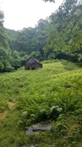
This cabin was restored in the early 2000s but they kept a lot of the original cabin. There is a book inside the cabin that tells of the Martin Caudill family and part of this once-thriving Basin Cove community. 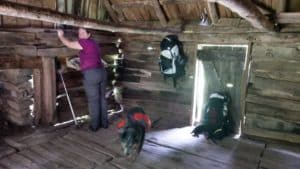
This cabin was one of the few structures that withstood the devastating 1916 flood. 
There is also a family tree and lots of pictures and information of the Caudill family that lived in this area. 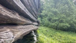
Recent Comments